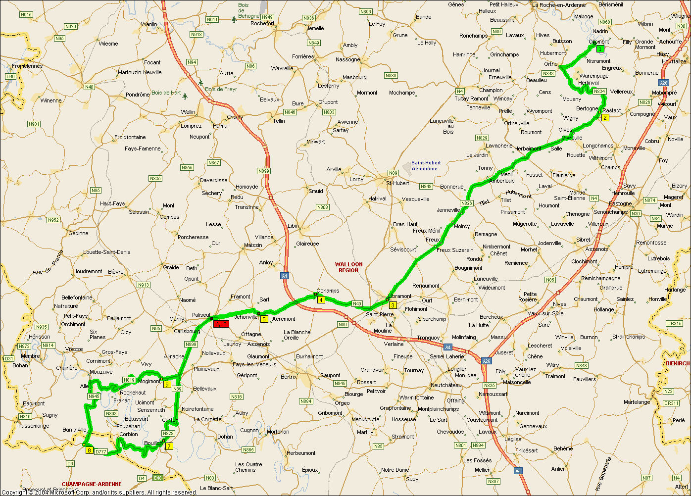
Nisramont - Frankrike - Nisramont
Route data
| Added by | balchen |
| Distance | 182,3 km |
| Ascent | 2205 m |
| Lowest point | 194 m |
| Highest point | 544 m |
Ride times
| Your speed | Your time |
| 20 kp/h | 09:06:53 |
| 25 kp/h | 07:17:31 |
| 30 kp/h | 06:04:35 |
| 35 kp/h | 05:12:30 |
| 40 kp/h | 04:33:26 |
Waypoints
| Name | From start | To end | From last | Altitude | Ascent | Descent | |
|---|
| Bertogne | 14,0 km | 168,3 km | 14,0 km | 420 | 0 | 0 | |
| Libramont | 42,5 km | 139,8 km | 28,5 km | 484 | 340 | 273 | |
| Paliseul | 62,3 km | 120,0 km | 19,8 km | 395 | 124 | 211 | |
| Buillon | 77,6 km | 104,7 km | 15,3 km | 226 | 116 | 287 | |
| Grense Frankrike | 88,5 km | 93,8 km | 10,9 km | 405 | 225 | 42 | |
| Alle | 99,9 km | 82,4 km | 11,4 km | 223 | 25 | 207 | |
| Paliseul | 121,0 km | 61,3 km | 21,0 km | 412 | 401 | 216 | |
| Libramont | 139,3 km | 43,0 km | 18,3 km | 502 | 204 | 115 | |
| Bertogne | 169,8 km | 12,5 km | 30,5 km | 436 | 284 | 351 | |
| Nisramont | 182,3 km | 0,0 km | 12,5 km | 360 | 163 | 235 | |
Places
Back